Note from DFS: Please note that there have been changes to the altitude information in the 2025 edition of the ICAO gliding chart.
This concerns in detail: Terrain heights and obstacles above 100 m / 328 ft GND are given in feet. In the airspace labelling, the altitude is only given in feet. The aerodrome altitude is given in feet. In the gliding sectors, the altitude is still given in metres.
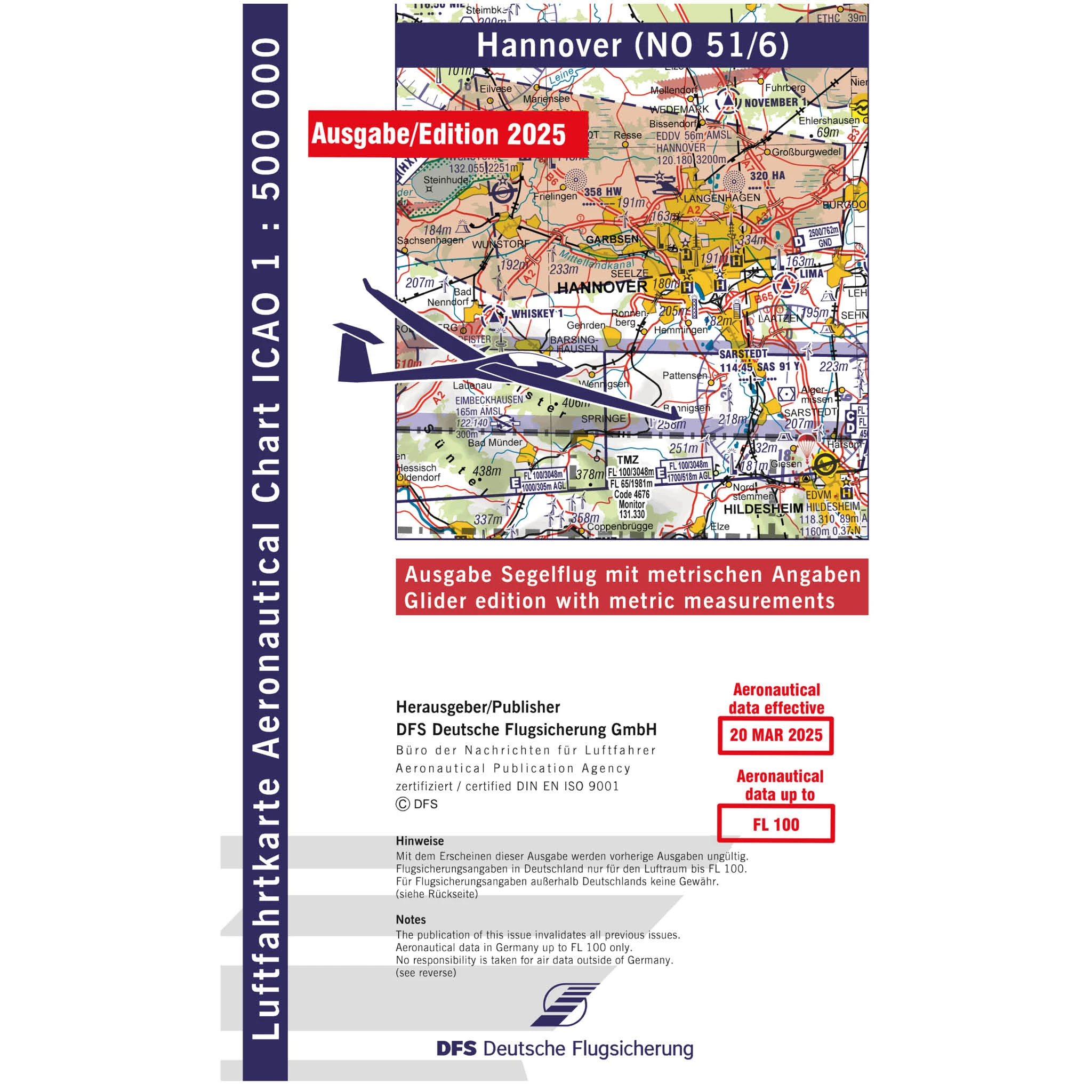
From 2026, the information will again be shown in metres as usual. The Gliding edition of the DFS Aeronautical Chart ICAO is specially designed to meet the wishes and needs of glider pilots in Germany by using metric data. The recognised and clear topographical representation of the ICAO chart is available in unchanged quality. The ICAO glider chart also fulfils the special needs of aerodrome, cross-country and competition glider pilots. With its specific aeronautical information, it offers more safety and flexibility in gliding.
- Detailed obstacle visualisation through the use of various symbols such as television towers, wind turbines and high-voltage pylons. - Labelling of airfields with F-tow operation. - All altitudes in metres. - Airspace dimensions in metres and ft/FL. - Detailed information on gliding sites such as terrain height, runway length and orientation and frequency. - Colour highlighting of all airfields with gliding operations. - Colour coding of gliding sectors (in C and D areas). - Large number of known turning points for gliding competitions. - Easier determination of turning points thanks to improved visualisation of the coordinate grid.
The back of the map contains the legend, the sectional plan of the entire map and information on the airspace structure. Based on the harmonisation of European ICAO charts, airspace classes C, D and E are coloured blue. Furthermore, the designation MSL (Mean Sea Level) is no longer used and AGL (Above Ground Level) is used instead of GND.
The ICAO aeronautical chart is divided into 8 areas - Hamburg, Rostock, Hanover, Berlin, Frankfurt, Nuremberg, Stuttgart and Munich.
Folded format: 14.5 x 24 cm Map sheet format: 83.5 x 61 cm Scale: 1:500,000
check_circle
check_circle
We use cookies for a better customer experience. However, the data collected will not be passed on to third parties at any time. You can deactivate cookies in your browser at any time.