The ICAO aeronautical chart is the standard chart for VFR flights in Germany.
It contains the topographical and air traffic control information that is important for VFR pilots: Roads, railway lines, rivers, forests, buildings, elevation points, obstacles, airfields (including terrain for gliding, hang gliding, microlightgliders, microlights, parachuting), airspace structure, VFR reporting points, radio navigation systems, frequencies for FIS, ATIS and VOLMET and much more. The back of the map contains the legend, the sectional plan of the entire map and information on the airspace structure. Based on the harmonisation of European ICAO charts, airspace classes C, D and E have a blue colour scheme.
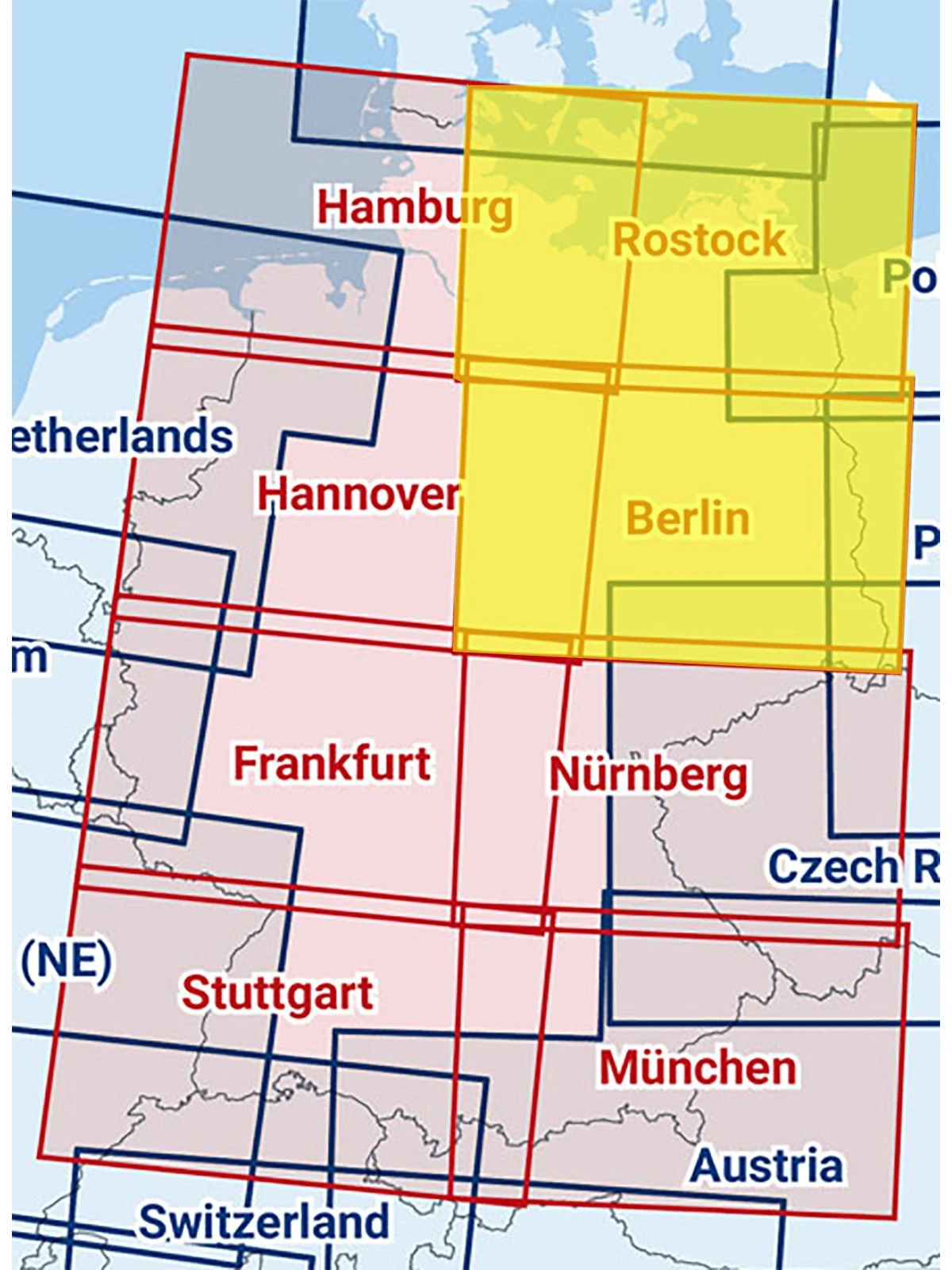
The ICAO aeronautical chart for Germany comprises a total of eight chart sheets - Hamburg, Rostock, Hanover, Berlin, Frankfurt, Nuremberg, Stuttgart and Munich.
Format per map sheet: 83.5 x 61 cm Scale: 1:500,000
This map sheet is: 2 maps - Rostock / Berlin - composite with foil cover. Composite maps are only available with foil and unfolded (plano)!
check_circle
check_circle
We use cookies for a better customer experience. However, the data collected will not be passed on to third parties at any time. You can deactivate cookies in your browser at any time.